















On Thursday night, a tropical depression strengthened into Tropical Storm Cindy in the Atlantic Ocean.As of the advisory on Friday at 5 a.m., Cindy was 990 miles east of the Lesser Antilles and had maximum sustained winds of 45 mph. The storm was moving west-northwest at 15 mph.”This general motion is expected to continue over the next few days. On the forecast track, the system is expected to remain well east and northeast of the northern Leeward Islands through early next week,” the National Hurricane Center said.Forecasters say gradual strengthening is expected in the next couple of days. However, beyond the next 48 hours, the deep-layer shear will combine with dry air, and likely weaken Cindy early next week.BELOW: WESH 2 Meteorologist Eric Burris takes a deeper look at the tropicsRelated: Tropical Storm BretRelated: WESH 2 Hurricane Survival Guide 2023Related: WESH 2 2023 Hurricane Season Forecast
On Thursday night, a tropical depression strengthened into Tropical Storm Cindy in the Atlantic Ocean.
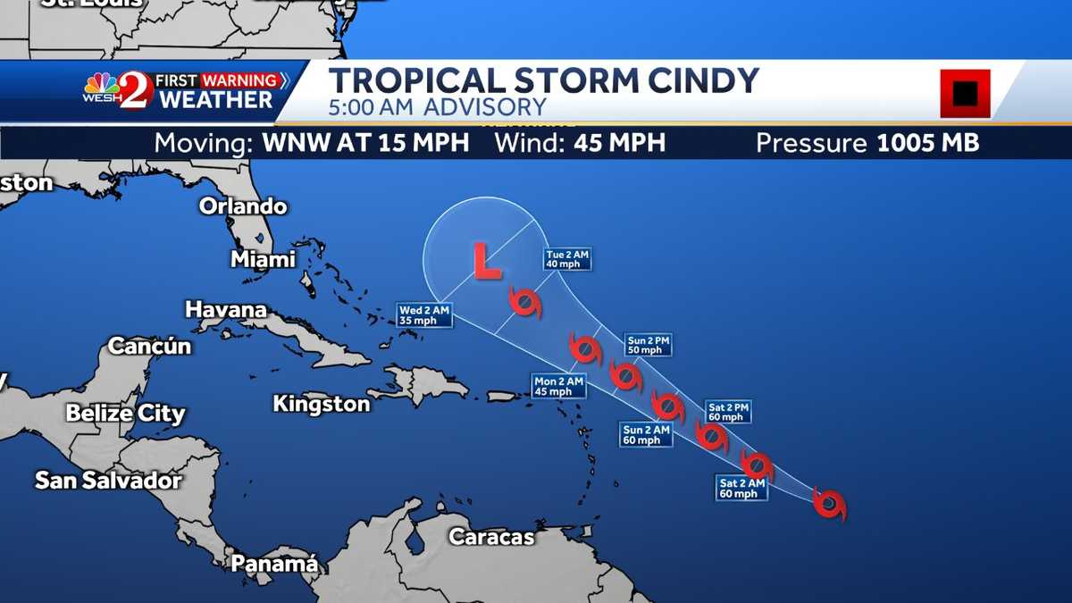
As of the advisory on Friday at 5 a.m., Cindy was 990 miles east of the Lesser Antilles and had maximum sustained winds of 45 mph. The storm was moving west-northwest at 15 mph.
“This general motion is expected to continue over the next few days. On the forecast track, the system is expected to remain well east and northeast of the northern Leeward Islands through early next week,” the National Hurricane Center said.
Forecasters say gradual strengthening is expected in the next couple of days. However, beyond the next 48 hours, the deep-layer shear will combine with dry air, and likely weaken Cindy early next week.
BELOW: WESH 2 Meteorologist Eric Burris takes a deeper look at the tropics
Related: Tropical Storm Bret
Related: WESH 2 Hurricane Survival Guide 2023
Related: WESH 2 2023 Hurricane Season Forecast
Credit: Source link