




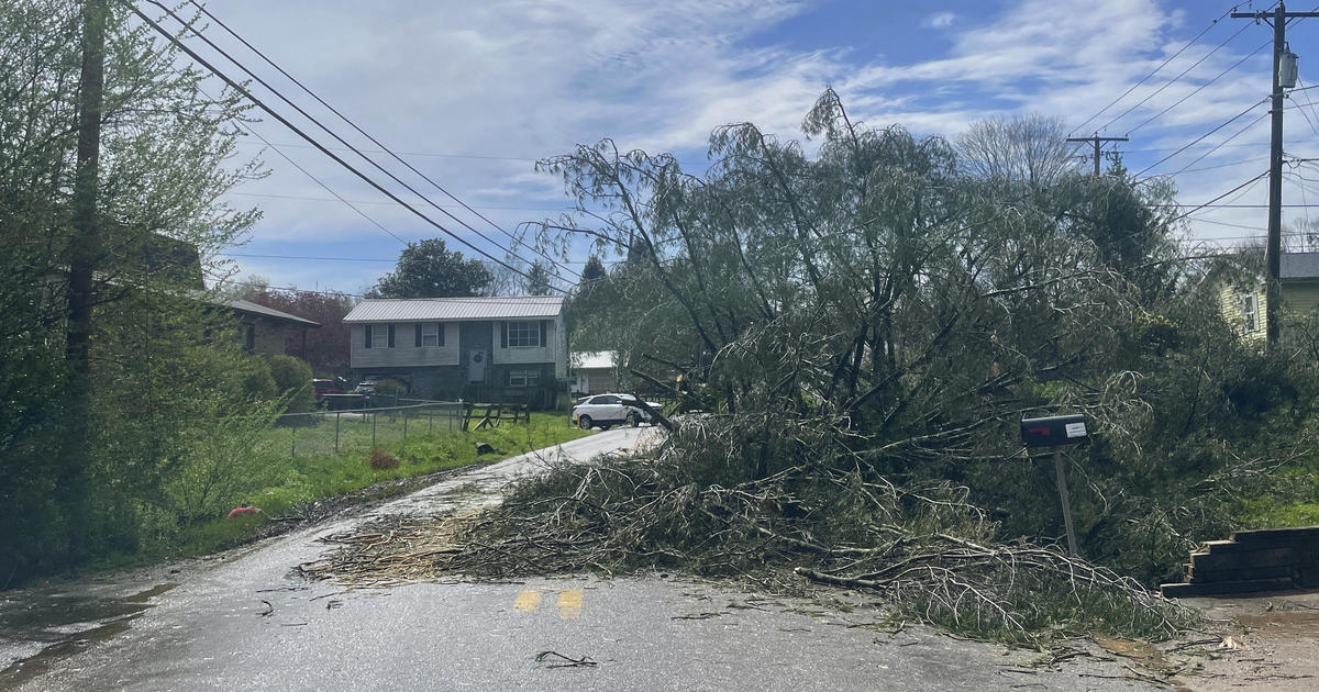

A surge of destructive storms lashed multiple states causing damage across the Ohio and Tennessee Valleys on Tuesday, with various tornado watches impacting millions and severe weather warnings spreading over a much wider slice of the country, from the Gulf Coast to the Great Lakes.
Violent wind gusts and heavy rain had already caused serious damage to some areas by mid-afternoon, wrecking buildings and forcing highway closures as crews worked to clear downed power lines, trees and other debris.
Where did the storms hit hardest?
Large sections of Ohio and Kentucky were contending with the most serious risks, along with a stretch of far-eastern Indiana. The Storm Prediction Center’s most recent severe weather outlook ranked threats in parts of those states at Level 4, of five levels, just before 12 p.m. CDT. Level 4 corresponds with “moderate” on that scale. Much of Kentucky and southern Ohio received that warning, including major cities like Cincinnati, Columbus, Dayton, Lexington and Louisville.
A tornado watch was also in effect for parts of central Kentucky and Tennessee, including Nashville and its surrounding areas. They expired at 3 p.m. CDT, although meteorologists warned that powerful “and potentially long-track tornadoes are possible from Indiana and Ohio southward into the Mid South” through the evening.
Storm Prediction Center / National Weather Service
“A threat for strong tornadoes may focus this evening into tonight across parts of Alabama and Georgia,” according to the storm prediction center.
A separate tornado watch was in effect until 6 p.m. CDT on Tuesday for parts of western Kentucky, southern Illinois, southwestern Indiana and southeastern Missouri. A tornado watch remains in effect until 2 a.m. EDT for parts of middle and east Tennessee.
The Tennessee Emergency Management Agency said Tuesday night it was aware of an “unconfirmed tornado that impacted the Sunbright community in Morgan County.” No injuries were immediately reported.
About 40,000 homes and businesses were without power Tuesday morning after an electric substation was struck by lightning, the AP reported. The singular substation affected two other stations causing the power outage.
Overall, forecasts anticipated that an outbreak of severe thunderstorms could touch portions of each of those states in addition to northeastern Mississippi, southeastern Illinois and southwestern Virginia throughout Tuesday, noting that “a few intense” tornadoes were among the primary hazards alongside damaging, and potentially hurricane-force, winds and scattered hail that could be baseball-sized in some places.
Winds are considered “hurricane-force” on the Saffir-Simpson Scale when their sustained speed reaches 74 miles per hour or higher.
April 2nd: A significant outbreak of severe storms, including strong tornadoes & widespread damaging winds, is expected today & tonight across the Ohio & Tennessee Valley regions into parts of the Southeast. For the latest forecast & watch info, visit https://t.co/QMmU4tCxt1. pic.twitter.com/gKj0hjUJDR
— NWS Storm Prediction Center (@NWSSPC) April 2, 2024
Roadways in Charleston, West Virginia, were littered with bricks stopping traffic and in some counties, trees were strewn across roads, lawns and cars, the AP reported. Gov. Jim Justice declared a state of emergency for Fayette, Kanawha, Lincoln, and Nicholas counties and urged people to “exercise extreme caution.”
A state of emergency was also declared in Kentucky as storms swept through the area and Kentucky Gov. Andy Beshear said in a statement obtained by the AP; “We have reports of substantial damage to a number of structures — and thankfully, as of right now we are not aware of any fatalities.”
How are tornado watches and tornado warnings different?
All thunderstorms have the potential to cause tornadoes, but atmospheric conditions need to be unstable in a particular way in order for that to happen. Meteorologists will issue a tornado watch when a mixture of atmospheric conditions and severe weather events suggest the formation of a tornado is possible in the area, but it does not necessarily mean that a tornado will occur.
When a tornado warning has been issued, it means a tornado has been sighted or indicated by weather radar and there is imminent danger to life and property. The National Weather Service recommends if a warning is issued to move to an interior room on the lowest floor of a sturdy building, for those outside or traveling to move to shelter to protect from flying debris.
Images of storm damage from the tornadoes
Powerful storms had already uprooted trees in Kentucky by midday on Tuesday. CBS affiliate WKYT shared a video of some of the damage, which included large branches, trunks and other debris splayed out over an intersection in a residential part of Lexington. In Nicholasville, another city nearby, authorities said they were investigating “a significant weather event” that impacted an industrial area. Images shared on social media appeared to show at least one structure partially torn apart after the incident.
“We have responded to a significant weather event,” said a spokesperson for the Nicholasville Police Department in a statement to CBS News. “There are no reported injuries.”
Meanwhile, a series of brutal storms barreled through parts of West Virginia throughout the day on Tuesday, with video footage capturing powerful gusts of wind picking up debris in the city of Charleston. The National Weather Service said radar indicated that there was a tornado in the Charleston area on Tuesday morning. Meteorologists forecasted those storms to abate to some degree as the system tracked toward Virginia.
John Raby / AP
The tumultuous storm system ripped through other parts of the country as it continued traveling east. Earlier, as it struck Oklahoma, a 46-year-old woman in Tulsa was swept away by flooding on Monday night. Andy Little, the public information officer for the Tulsa Fire Department, told CBS News that crews were still searching for her on Tuesday morning.
Are the severe storms over?
Looking ahead to the rest of the week, meteorologists said there is “a slight risk” that regions along a huge stretch of the East Coast and somewhat inland could be hit Wednesday with strong and severe storms. Those storms could potentially bring hail, damaging winds and one or two tornadoes to places within the risk area, from the Chesapeake Bay down to Florida.
Rain and some sleet will hit eastern Massachusetts on Wednesday during the day and by nighttime there will be sleet and possible snow accumulation. Higher elevations in central and western Massachusetts will see wet snow.
Pittsburgh remains under a flood watch through Wednesday morning. Electric companies are preparing for high winds, hail and heavy winds that could damage electrical equipment and result in power outages.
Maryland might see severe thunderstorms through Wednesday capable of producing intense lightning, heavy downpours. and hail.
Credit: Source link