







Widespread rain is making its way northeast toward Central Iowa and will overspread our area beginning in the southwest as early as mid-morning and continue to progress northeast through the midday and afternoon hours. Winds will also remain very breezy with sustained winds of 20-25 mph out of the southeast and gusts potentially topping 30mph. Rain will likely remain continuous overnight through Monday afternoon as the primary area of low pressure with this system lifts northward across the state and begins to retrograde back to the west. High temperatures on Monday will occur early in the day before temperatures fall into the 30s by evening as colder air wraps around the backside of the low pressure. Dry air will briefly wrap into the system allowing for a break in the rain late Monday into Tuesday for parts of the state, but continuously dry periods are not expected until after Wednesday.Wintry Precipitation Potential: As of now, the highest probabilities of wintry precipitation (freezing rain/snow) continue to line up over western portions of the state beginning mid-morning Monday. A brief period of freezing rain may occur for areas along HWY 71 and points west from Monday-morning to late afternoon Monday resulting in a glaze to a few hundredths of an inch of ice. This ice potential should be mitigated quickly as the atmosphere aloft cools quickly resulting in a changeover to light snow. Farther east into Central Iowa, only trace to a few tenths of an inch of snow are possible and that is really pushing it considering daytime temperatures will be above freezing.Precipitation Amounts: A widespread 0.5 to 2.5″ of rain is possible, which would be some of the best rainfall parts of the state have seen in months. The heaviest swath of rain will likely occur along the I-35 corridor and into western Iowa. Lighter amounts are anticipated east of I-35, but all of Central Iowa will end with a healthy soaking rain. Interactive Radar | Weather AlertsIowa Weather Forecast:Christmas Eve Night: More rain showers. Low 50F. Winds ESE at 10 to 20 mph.Christmas: Steady moderate rain through early afternoon. Total rainfall of 1-2″. Morning high of 52F, with falling temperatures through the day. Winds shifting to the SW at 10 to 15 mph. Gusts up to 20 mph.Christmas Night: Cloudy night. Wintry mix possible, especially in western Iowa. Low 31F. Winds SSW at 10 to 15 mph.Tuesday: Rain and snow showers at times, otherwise cloudy. High near 37F. Winds S at 10 to 15 mph.Tuesday Night: Cloudy with a few showers. A few snowflakes may mix with the rain. Low near 30F. Winds N at 5 to 10 mph.
Widespread rain is making its way northeast toward Central Iowa and will overspread our area beginning in the southwest as early as mid-morning and continue to progress northeast through the midday and afternoon hours. Winds will also remain very breezy with sustained winds of 20-25 mph out of the southeast and gusts potentially topping 30mph. Rain will likely remain continuous overnight through Monday afternoon as the primary area of low pressure with this system lifts northward across the state and begins to retrograde back to the west. High temperatures on Monday will occur early in the day before temperatures fall into the 30s by evening as colder air wraps around the backside of the low pressure. Dry air will briefly wrap into the system allowing for a break in the rain late Monday into Tuesday for parts of the state, but continuously dry periods are not expected until after Wednesday.
Wintry Precipitation Potential:
As of now, the highest probabilities of wintry precipitation (freezing rain/snow) continue to line up over western portions of the state beginning mid-morning Monday. A brief period of freezing rain may occur for areas along HWY 71 and points west from Monday-morning to late afternoon Monday resulting in a glaze to a few hundredths of an inch of ice. This ice potential should be mitigated quickly as the atmosphere aloft cools quickly resulting in a changeover to light snow. Farther east into Central Iowa, only trace to a few tenths of an inch of snow are possible and that is really pushing it considering daytime temperatures will be above freezing.
Precipitation Amounts:
A widespread 0.5 to 2.5″ of rain is possible, which would be some of the best rainfall parts of the state have seen in months. The heaviest swath of rain will likely occur along the I-35 corridor and into western Iowa. Lighter amounts are anticipated east of I-35, but all of Central Iowa will end with a healthy soaking rain.
Interactive Radar | Weather Alerts
Iowa Weather Forecast:
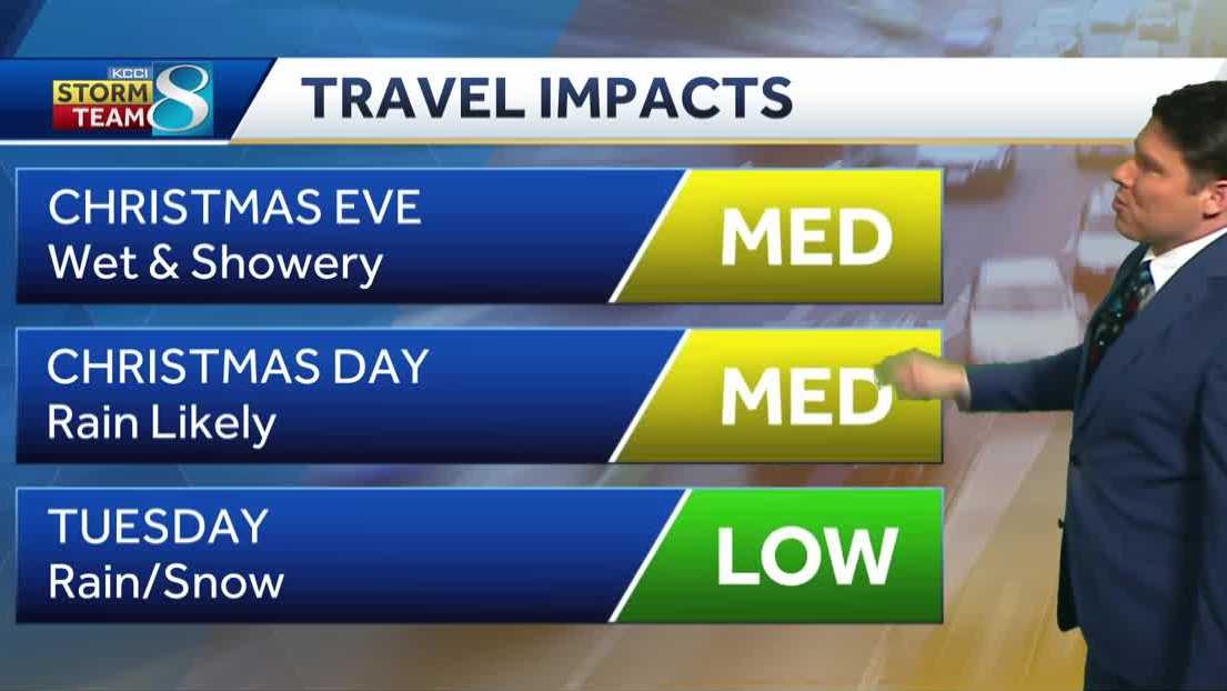
Christmas Eve Night: More rain showers. Low 50F. Winds ESE at 10 to 20 mph.
Christmas: Steady moderate rain through early afternoon. Total rainfall of 1-2″. Morning high of 52F, with falling temperatures through the day. Winds shifting to the SW at 10 to 15 mph. Gusts up to 20 mph.
Christmas Night: Cloudy night. Wintry mix possible, especially in western Iowa. Low 31F. Winds SSW at 10 to 15 mph.
Tuesday: Rain and snow showers at times, otherwise cloudy. High near 37F. Winds S at 10 to 15 mph.
Tuesday Night: Cloudy with a few showers. A few snowflakes may mix with the rain. Low near 30F. Winds N at 5 to 10 mph.
Credit: Source link